Summary:

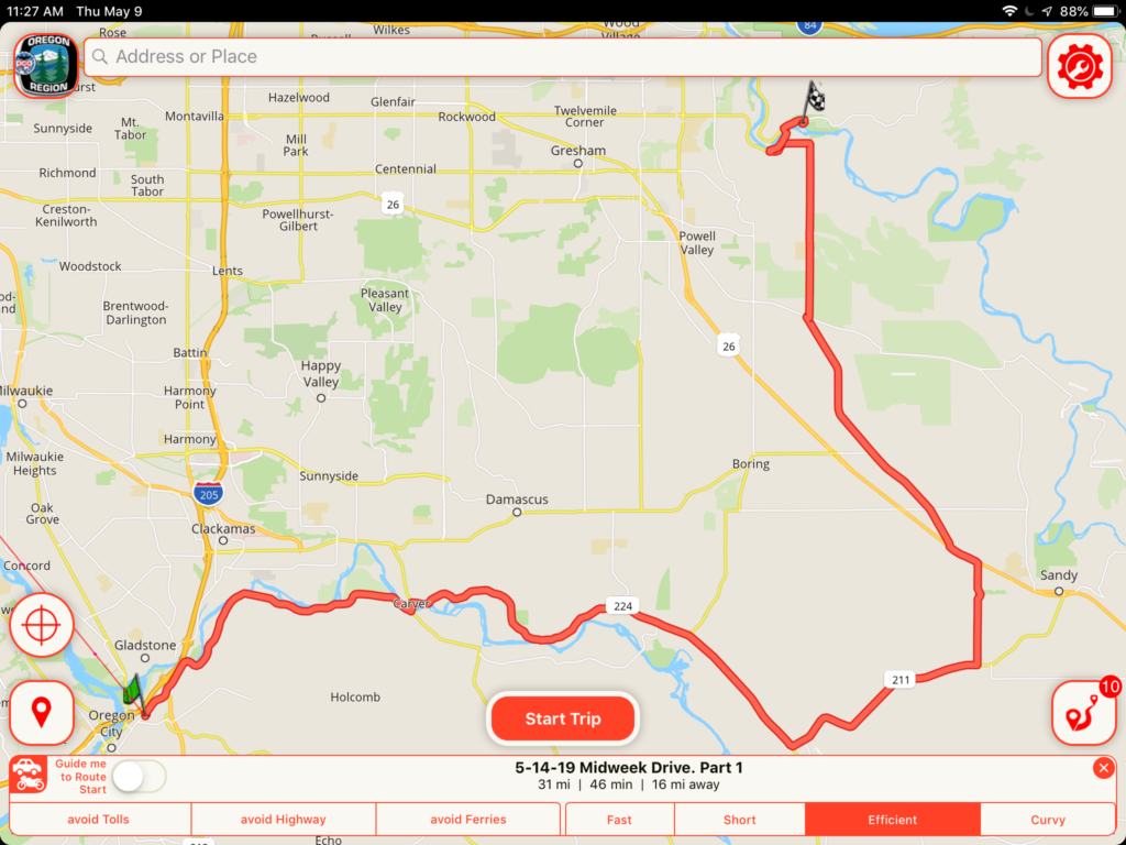
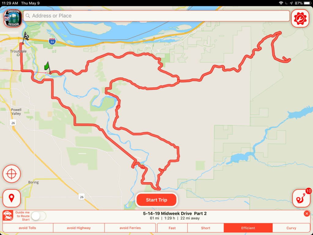
Start at the End of Oregon Trail Parking lot in Oregon City. From there you take backroads to Dabney State Recreation Area at the Sandy River for a stop. Then you continue to the Old Columbia River Highway, wind your way up and down Larch Mountain Road and then through backroads to Troutdale for Lunch.

Tour Document:

Original Date:

5/14/2019

Last Update:

N/A

Starting Point:

End of Oregon Trail – Parking Lot
1726 Washington Street 
Oregon City, OR 97045

Destination:

Rest Stop:
Dabney State Recreation Area

Lunch Stop:
Ristorante Di Pompello
177 E Historic Columbia River Hwy, Troutdale, OR 97060

Tour Distance:

~92 Miles (31 Miles + 61 Miles)

Driving Time:

~2 1/2 hours 

Scenic App:

This tour is in the ORPCA club library for the Scenic App.
There are 2 route parts titled:
5-14-19 Midweek Drive Part 1
5/14-19 Midweek Drive Part 2
Scenic User Guide

Google Map:

URL for Google Maps:

Part 1
Part 2

GPX: 

GPX data for your Navigation App:

ORPCA Member Login

ORPCA Member Logout